As a sketchbook task in the lecture today were presented with a list of countries to choose from in which we had to find via google maps or street view and a subject along side them.
Elverum, Norway – History
McAllen, Texas – Economy
Kansas (state) – Agriculture
Omsk, Russia – Sport
Vancouver, Canada – Immigration
Arlington, VA – Patriotism
Minneapolis-St Paul, Minnesota – Health
Gdansk, Poland – Politics
These were the options and I decided to choose McAllen Texas- economy.
“You should, (through introductory research) choose how you might best represent and approach your theme or message in the production of a series of 10 images sourced through Google Earth and/or Google Streetview. “
I started the task buy firstly researching the definition of economy- “The state of a country or region in terms of the production and consumption of goods and services and the supply of money.” This prompted me to research into the economy of McAllen Texas and through that I found that McAllen is one of the 10 fastest growing cities in the US.
For the images themselves I decided to research into some of the key parts of McAllen TX and find them via google maps and street view.
 This first image shows just how close McAllen is to the Mexican border and that links to the article I found on which there is the most arrests for attempting to cross the border illegally.
After researching more into the town I found that its also one of the biggest cities in Texas that has a substantial line between rich and poor.
 This image is off the Border Control in McAllen TX. I wasn’t able to view this area via Street view so I chose to use the image of the satellite view.
 This photograph was taken on street view at the McAllen Conference Centre of Lake. I think this image is quite good quality despite being taken with google street view.
 This is an image I took whilst trying to search for McAllen station however google maps took me here instead. I think that considering McAllen has one of the most substantial lines between those how have money and those who don’t I think this image makes the City look quite beautiful. The Palm trees along side the road remind me of California and not a city that has only recently started to gain a good economy.
 This is a satellite image of the city of McAllen TX. I decided to use this image to show the size of the city.
 This photograph was taken via street view of McAllen Town Hall.
 This was a photo I took via Google street view of the Water Park in McAllen. To find this park I used Google to search for some of the top places to visit in McAllen. The park looking lost and un-used seems for me is a great metaphor to show how the city itself is struggling with the divide between rich and poor in the economy.
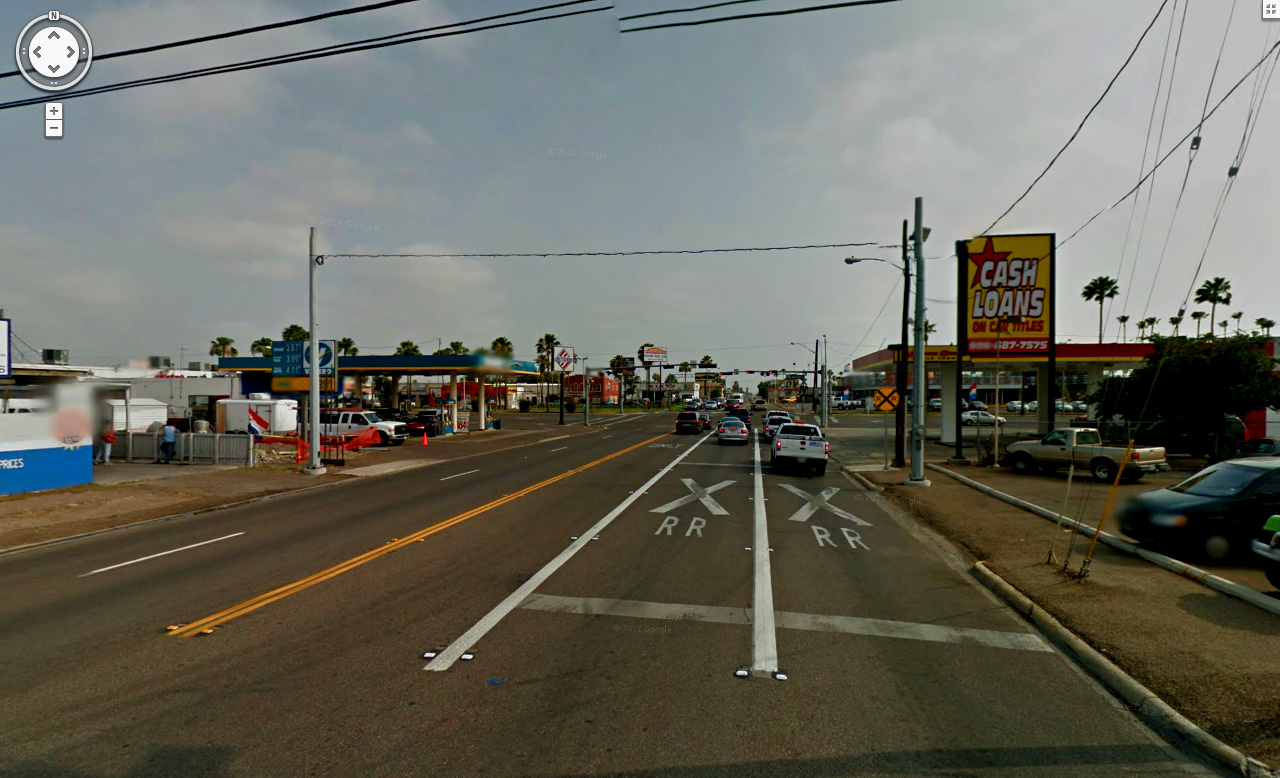 This image was taken on Google street view as well. I decided to take this picture as even though the city does not look in financial battle the Cash Loans store adds a sense of irony to the image.
 This image is off the Mall in McAllen TX. At first it was difficult to find a shopping centre which was quite surprising considering that McAllen is one of the best up and coming cities but I thought that this place would be a good representation of the economy.
 This image is another road in McAllen and I chose to take this image by Street View to almost show the other side of the city as the street seems quite empty and abandoned.
Overall I really enjoyed at the Sketchbook task and through the task I’ve realised its possible to create an almost professional looking photograph via Google Street View.
